Auchenfranco Castle
Auchenfranco Castle Details
Auchenfranco Castle, faint earthworks of rectangular ditched motte said to have contained masonry
- Closest To: Lochfoot, Cargenbridge, Dumfries
- Access: S.O.A.C. Public Access
- Grid Reference: NX892724
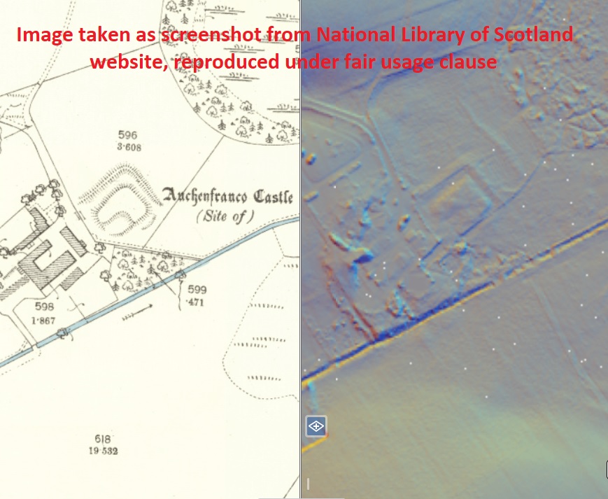
Auchenfranco Castle is a small rectangular earthwork which partially survives at the western end of Lochrutton Loch, west of Dumfries. It is fairly well-defined, with an external rampart and raised platform contained within a wide ditch, but the whole is much denuded and not easy to see from the ground. The occupants of the property were dismissive of it as a castle when I visited, and declined permission to photograph it. A different and larger earthwork at the other end of the loch, called “Moat” is most likely a Roman fortlet, and not associated with this site. In 1850, it was recorded that some masonry had survived, but had been removed to aid cultivation. None remains to be seen today.
The superiority of the lands of Auchenfranco were held by the Griersons of Lag from at least 1474, when Vedast Grierson resigned the superiority to his son Roger. The Griersons had presumably held the land from the Douglas Lords of Galloway up until that family’s fall in the 1450s. Roger fought at Sauchieburn in 1488 and died of his wounds soon afterwards, and his son Roger died at Flodden in 1514. In 1526 John Grierson held the superiority of “Auchinfranquhare”, and had a lengthy career, dying eventually in 1566. His eldest surviving son Roger signed the bond in support of the infant James VI, and eventually died in 1593. At about this time, Timothy Pont produced a map of Nithsdale which shows “Ackinfranko” as a modest tower near “Loch Ruttoun”. Roger’s son William married the daughter of William Maxwell, Lord Herries – it may be that Auchenfranco was given to Herries as part of the marriage agreement since in July 1601, part of “the £5 land of Auchenfranco called the Moit of Auchenfranco” was granted by William Herries to his wife upon their marriage. Subsequently, Auchenfranco is not named upon maps of the area, although an unnamed settlement is shown here on Blaeu’s mid 17th century map, and by Roy’s mid 18th century map this is known as Markland. In 1699 two Herries brothers are named as “of” Auchenfranco, and in the 19th century it was purchased after the death of a Maxwell of Auchenfranco.
It is likely that the earthwork represents a medieval period moated manor that was held as part of the Lordship of Galloway, one which remained the seat of a small estate farmed by the Griersons for the earls of Douglas. Whether there was ever a significant building at this date is unknown, but it seems probable that after the fall of the Douglases, the Griersons elected to proclaim their increased status by erecting a hall of some description, and this may have been a tower and courtyard similar to that at Lag itself. How long this tower remained in use is unknown, and what its eventual fate was, is also unknown – however it does at least appear to have remained in use after the 16th century wars with England. It may be the case that it was abandoned or fell into disrepair after it passed to the more powerful Herries family, and after the Union of the Crowns in 1603, being abandoned as anachronistic in favour of a more domesticised manor or farmhouse, and eventually the moated area itself fell into disuse.
Become a supporter of my work to access a more detailed history