New Radnor Castle
New Radnor Castle Details
New Radnor Castle or Radnor, e/w & covered footings of large C11-C15 royal castle
- Closest To: New Radnor
- Access: Free Public Access
- Grid Reference: SO21126102
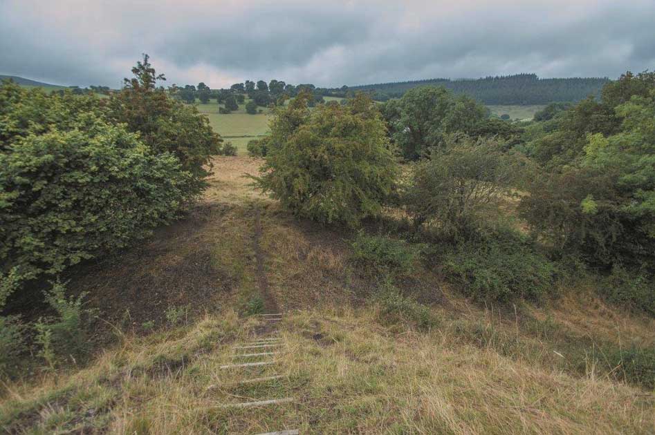
New Radnor Castle is a substantial castle that survives as earthworks and grass-covered footings adjacent to the planned settlement of New Radnor. It is freely accessible to the public at no cost, with parking in the village and a slightly overgrown footpath providing the way in.
The castle started out as a natural promontory overlooking a river confluence, but was modified so that an oval motte surrounded by a substantial ditch and bank occupied the south-eastern end of this promontory, protected by a second substantial ditch, and a curving rectangular bailey protected by a lesser ditch and perimeter bank lay across the approach to the north-west, with a possible barbican at the south-western corner surviving as a ditched platform. The settlement at the base was also provided with a bank and ditch defence.
The Domesday Book records a castle at Radnor as being crown property, and a crown castle of Radnor is also mentioned in the 12th century, and despite suggestions of other sites nearby being the sites referred to, the scale of the structures here is telling, and it seems likely to me that the castle here had been built by 1096 (perhaps by William fitzOsbern), and subsequently held by Philip de Braose, to dominate the lands of Elfael. It had a turbulent history, being repeatedly attacked by the Welsh and with destruction episodes in 1196 at the hands of the Lord Rhys ap Gruffudd, 1216 at the hands of King John, 1231 at the hands of Llywelyn ab Iorwerth, and after it was rebuilt at the instruction of the Earl of Cornwall for Roger Mortimer of Wigmore in 1233, it was destroyed in 1264 at the hands of Llywelyn ap Gruffudd and Simon de Montfort. It was sacked again by the men of Owain Glyndwr in 1401, who seem to have executed the 60 man garrison. It had fallen into disrepair by the 16th century, but was used as a prison in 1535, and housed Prince Charles in 1642, after which it was dismantled at the orders of Parliament.
The castle has not been subject to systematic archaeology, but it is clear that the motte was crowned with a stone curtain wall, and had four mural towers in addition to the square keep, with a gateway in the wall presumably reached via a timber bridge. The bailey was also defended in stone, with the walls linking up to the town walls which date to the second half of the 13th century. On top of the motte it is possible to trace the dimensions of the keep and its cross-wall, together with a range of buildings along the southern curtain, and to postulate the locations of the curtain wall itself and two of the mural towers. Access to the summit from the bailey is via some rather dilapidated wooden steps and through a break in the ground levels which may reflect a sloping access through the curtain wall. Two causeways cross the ditch adjacent to the bailey, but it is not clear which – if either – of these was in use in the medieval period, and a complex of earthworks including the platform of St Mary’s Church makes the interpretation of how one gained access to the castle tricky.
Become a supporter of my work to access a more detailed history