Balmaclellan Mote
Balmaclellan Mote Details
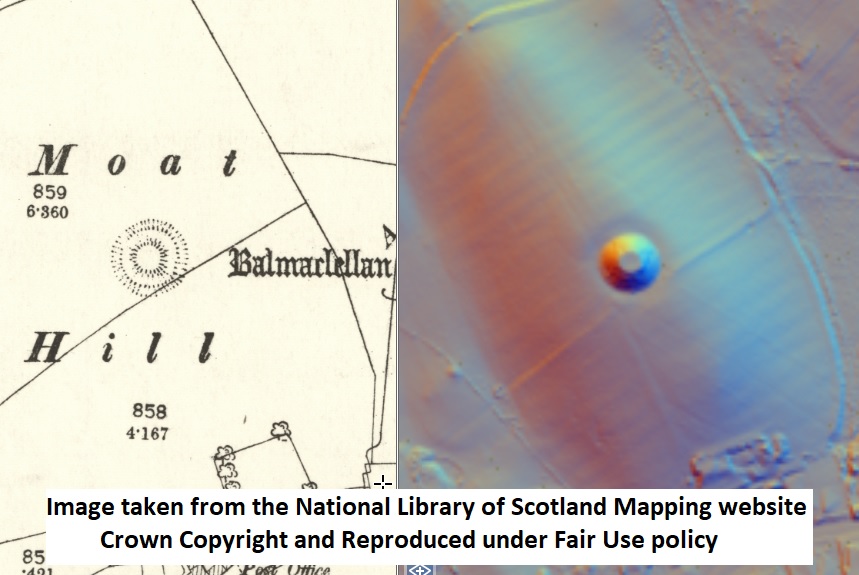
Balmaclellan Mote, a large ditched motte occupying natural hilltop site; ditch largely ploughed out
- Closest To: Balmaclellan, New Galloway, St Johns Town of Dalry
- Access: S.O.A.C. Public Access
- Grid Reference: NX652793
Balmaclellan Mote is a modest ditched motte sitting on a natural ridge above the settlement of Balmaclellan on the east side of the Water of Ken. Between the motte and the settlement is the valley of the Aquavitae Burn. The land hereabouts is rough and broken, and it does not seem likely that the motte could have served as a centre of lordship, instead a hunting retreat of watch-point seems more likely.
The motte has a summit about 11 metres in diameter, and rises about 5 metres above the surrounding land; the ditch is perhaps 4.5 metres wide and has undoubtedly silted up or ploughed out as it is only about half a metre deep. Balmaclellan was called Trevercarcou/Gretquerqu in the 13th century, and was royal land, although it had been granted to the Earl of Dunbar and occupied by David de Graham by 1237. King Robert I considered the area a royal hunting forest, but it was largely unusable for much of the early 14th century due to the dominance of Edward Balliol. By 1408, the name Balmaclellan was in use, perhaps reflecting deliberate resettlement of the area under the Douglas Lords of Galloway. By this time the motte was almost certainly out of use.
Become a supporter of my work to access a more detailed history